The plan was to do a traverse of the Bernese Alps; follow a route which began
in Les Diablerets , Switzerland, climbing the peaks of Diablerets (3209m), Arpellistock
(3025m), Wildhorn (3247m), Schnidehorn (2937m), Wildstrubel (3243m) and Rote
Totx (2808m) descending to Kandersteg then taking in the Mutthorn, Jungfrau
(4158m) & Abeni Flue (3962m) en route, but the weather put pay to that on
day one!!
All began well with us all meeting up in the pretty hamlet of Vers Elgise a
couple of kilometers south of Les Diablerets.
|
Day 1
Delightful spring weather had preceded the journey and it was
with initial joy to open the curtains to a covering of fresh snow
on the morning of the first day - the few centiliters forecast
eventually turned into 60cms. Arriving in Les Diablerets we discovered
all lifts closed and no means of getting ourselves to the Prarochet
hut.
An escape by train to Leuk and then by hairy bus ride to Leukerbad
and up the Telecabine saw us begin our next harebrained scheme
to make the Lammerenhutte by dusk.
In true Eagle spirit we set off in a white out, skinning through
1 meter of fresh powder at 16:45 was possibly not our best decision.
A retreat to the valley, and a night in a 4 star hotel with fine
dining was our alternative to the Lammerenhutte. This was the
only hotel / hostel with rooms available, it being Easter week
end.
|
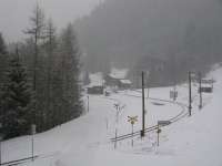 Morning view
 |
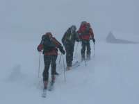 Retreat back to Valley
 |
|
Day 2
Leukerbad
Continuing with the tour was out of the question the next day but
conditions on the Leukerbad pistes were superb and the day spent
in the resort proved to be an excellent alternative.
|
|
|
Day 3
Gemmi Pass to Lammerenhutte, then accent of
the Steghorn 3146m
The following day brought the weather and snow conditions we had
dreamed of and eventually our tour began with a return to the Gemmipass
and the skin up to the Lammerenhutte (2501m).
With the mountains in perfect postcard state, les Aigles were in
heaven as the group (minus Ali), set off to conquer the Steghorn
(3146m). But the theme of the week had already been established
and the peak was reached in 20m visibility, strong wind and tracks
covered in fresh snow. Keith's excellent navigation brought us back
to base, only once disappearing through a small cornice.
Distance 15Km; assent 830m
|
|
|
|
On route to the hut
|
Summit of the Steghorn 3146m
|
|
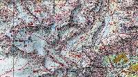
Route to Lammeranhutte
|

Steghorn route
|
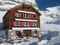 Lammerenhutte
 |
|
Day 4
Wildstrubel 3243m
Overnight saw yet more snow fall, followed by
a fabulous cold blue sky morning. The weather came in again so
only Keith, Steve G and Ali made it to the top of Wildstrubel
as Hans and Steve M preferred to make good use of the descent
(twice) whilst there was still visibility to see their tracks.
Steve B (yes a group with three Steve's out of 6 members!), was
recovering from Steghorn-inflicted return of flu symptoms.
Distance 13Km assent 740m
|
|
Steve Moore breaking trail
|
|
|
Day 5
Kandersteg
More snow and strong winds in the afternoon and
overnight threatened a day of incarceration in the Lammerenhutte.
But that Eagle spirit prevailed and despite the white out, the decision
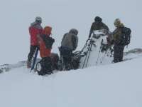
to move onto Kandersteg via the Rote Totx Lucke (2808m) was taken.
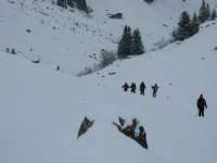
Despite very deep, heavy snow that had most of
us more down in the snow rather than skiing the only decent descent,
it was just what we needed - a good long day out and getting further
along our route.
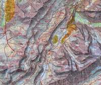
The Gemmi hotel in Kandersteg is exceptionally good value for a
dormitory and eat as much breakfast as you want (and can carry)
25CHF.
Distance 15km; assent 300m
|
|
Route to Kandersteg
|
Rote Totx Lucke (Col)
|
The slog through deep snow
|
|
|
Day 6
Train to Wieler (Lauchenralp) - Hochenhorn (3293m)
- Loetschpasshutte
The previous evening many of the group ate horse, which may well
have taken its revenge as Steve M was feeling ill the next morning.
This was a shame as being the best skier of the group he missed
out on a morning's perfect powder in the resort of Laucheneralp
- a train and bus ride away from Kandersteg. The morning had started
off with more snowfall which magically turned to blue sky as soon
as we arrived at the top lift. This was the best snow ever, until
it turned heavy at midday and a couple of us experienced 'sticky
ski.'
The route to the Loetschpasshutte was a delightful ski from the
top lift - rather reminiscent of Cairngorm, with much exposed rock
and patches of good snow. En route, Keith led Hans and Ali up the
Hochenhorn, a grade one climb up the side that looked fine but wasn't
shown on the map as the route. The loud crack as Keith was a bit
off the summit gave him a wee shock and with the snow cap settling
in its new position, we retraced our steps and lived to tell the
tale. The hut, with its gorgeous guardiennes, will be 5* accommodation
when its finished, but meanwhile you still need to boot and duvet
up to visit the one toilet.
Distance 3Km; assent 200m
|
The Loo!!
One at a time please.
|
|
|
Day 7
Descend to Valley & Train to Lauterbrunnen
Ali & Steve B were to fly home this evening,
so they chose to reverse the short tour of the previous day, and
descend the pistes to Lauchneralp. The others took what turned out
to be a disappointing descent with much poling, back down to the
valley. We all met up again by chance waiting for the bus to the
station and finally said our good byes at Spiez station. The remaining
four carried onto Lauterbrunnen, in the rain, staying over night
in the Valley Hostel (25CHF).The weather proved too much for Steve
Moore and despite the weather forecast indicating that there was
to be three days of good weather he to decided to go home.
|
|
|
Day 8
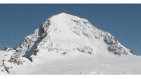
Train to Jungfraujoch - Monchhutte & an
attempt at the Monch (4107m)
The remaining three caught the 0630 train the following
morning to the Jungfraujoch, in clear blue sky's.
We arrived at the Monchhutte in good time leaving for an attempt
on the Monch after some refreshment. Steve Gold was hoping to lay
the ghost of his 2006 accident. On reaching the arête half
way up, it was decided we could not protect the crossing safely
with only one ice screw and 30m of rope, the avalanche risk was
high as about 20cm of unconsolidated snow lay on hard ice, so we
retreated. An hour after our return to the hut the wind got up and
the cloud came in, we had made the right decision
The reason for our retreat from the Monch as well as the guardian
saying that no one had been up the Jungfrau for weeks, impacted
on the next day, as we decided not to attempt the Jungfrau, which
was to have been our main objective.
Distance 4; assent 400m.
|
Animate route
|
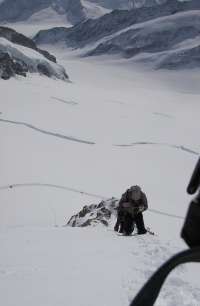
Ascending the Monch
|
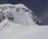 The arete where we turned back
(3900m) |
|
|
Day 9
Monchhutte - Louroihorn (3770m) - Hollandiahutte ( 3240m)
The following day was bright and sunny again as we ascended the
Louroihorn (3770m), then we had a brilliant ski down the Kranzburgfirn
on route to the Hollandia hut. We arrived there at 1400. What a
cold hut, the only room above zero was the dinning room! Steve and
Keith needed to use 4 blankets in the dormitory to keep warm.
Distance 12Km Assent 700m
|
|
|
|
|
Animate route
|
Summit of Louroihorn
|
Hollandiahutte
|
|
|
Day 10
Abeni Flue (3962m), Mittaghorn (3892m) - Weiler
We had the latest breakfast possible and were the last to leave
the hut at 0815. The guardian was expecting a lot of Heli skiers
and wanted us all gone by 08:00!
We topped out on the Abeni Flue at 11:00 and then tackled its
fiercer neighbor the Mittaghorn. This was a superb expedition
of SGA standard. The ascent required carrying skis for 200 m height
gain, first on a rock ridge, then a short abseil and finally a
long partly iced exposed arete which with relief we managed to
climb on nevee. We topped out at 1400. We needed an ice screw
to protect the icy descent from the summit into the SW bowl. Below
this was the ice fall which had to be avoided by a difficult,
steep, crevassed, exposed traverse right in bad (soft) snow conditions.
It was getting late and the snow below was part slush and part
setting concrete. After two major peaks we were tired and to our
dismay the Anenhutte wasn't open, so we skied to Batten, then
a bus and found a convenient hotel in Wiler opposite the cable
car, it was18.45pm by then (the Sporting hotel CHF65 ppn B&B).
Distance 22Km; assent 1100m
|
Animate route
|
|
|
|
Ascending the exposed arete of the Mittaghorn
|
Tricky decent from summit
|
|
|
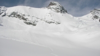
Animate decent though lower section of upper Anungletscher.
After the exposed traverse
|
|
|
The exposed traverse
|
Decnding to Batten past Fafleralp
|
|
|
Day 11 & 12
The following day was snowing with poor visibility but some piste
skiing was done.
The final airport day was sunny again; from the top of the lift
system we skied and skinned up past the Sackhorn to a point close
to the Petersgrat and descended the Tellin valley/gully system,
an excellent outing including a long steep sustained couloir.
Distance 8Km; 200m assent
|
|
|
|
|
Animate
|
Upper Tallin decent
|
Mid Tallin decent
|
|
|
Guidebook used O'Connor.
Maps used 1:50,000 Carte Nationale de la Suisse.
Cost was around £1000; this worked out to be more than anticipated
due to the hotels and extra travel. But it was 12 days.
|
Video of the trip (each clip 6.5 - 17meg)
|

